
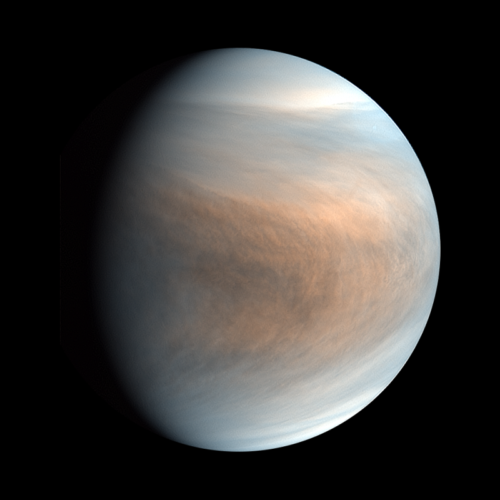
On December 14th, 1962, Venus became the first planet to receive a visit from a spacecraft. 61 years have passed since Mariner 2’s brief and historic flyby. Despite this, we still have more open questions than concrete knowledge about the nearest planet. Venus’ extreme atmosphere features a pressure of 93 bars, a temperature of 880 degrees Fahrenheit (470 degrees Celsius), and corrosive molecules such as sulfur dioxide. The atmosphere disables even the most rugged landers in a matter of hours, and it creates difficulties for spacecraft attempting to capture high-resolution images from orbit. As a result, Venus has received less attention than other planetary destinations over the past three decades.
NASA and its partners are attempting to remedy this lack of attention with a series of missions which will launch in the early 2030s. The spacecraft which will lead the way back to Earth’s “evil twin” is the Venus Emissivity, Radio Science, InSAR, Topography, and Spectroscopy (VERITAS) mission. After a trying year of externally-imposed delays and budget cuts, there appears to be signs of hope for VERITAS. The mission’s scientific rationale is developing, and the U.S. Congress has indicated its desire to fund the mission. This mission is crucial for the future of planetary science as we attempt to understand why Earth is habitable while other neighboring planets are not.
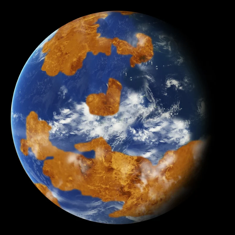
The resurgence of interest in Venus was triggered by a series of surprising discoveries about this planet. Climate models developed at the Goddard Spaceflight Center indicate that the planet might have had oceans of liquid water for up to three billion years [1]. If this is true, Venus would have remained habitable long after Mars lost its habitability. Some researchers hypothesize that it only lost its oceans 750 million years ago when a catastrophic episode of volcanism released large quantities of carbon dioxide into the atmosphere and triggered a runaway greenhouse effect. Therefore, Venus is a cautionary tale about how Earth-sized planets can be irrevocably changed by sudden alterations to their atmospheres. In 2021, a team led by the University of Cambridge’s Jane Greaves detected phosphine gas in the planet’s atmosphere. On Earth, phosphine is only produced in large quantities by microbes, which raised the possibility that Venus’ clouds still harbor extant life. However, these claims have since been contested, most notably by NASA’s now-defunct SOFIA flying observatory [2].
Venus also has bizarre surface features which expand our outlook on what is possible on other worlds. Its mountains might be capped by pyrite snow, and its river-like channels could have been carved by liquid sulfur or carbonate. Unique “pancake domes” might be made of viscous magma with the constituency of tar. This magma, known as rhyolite, would trigger an explosive eruption on Earth, but it can flow under Venus’ dense atmosphere.

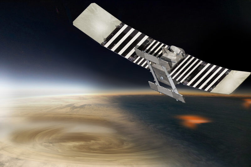
A detailed and accurate map is a prerequisite for in-depth exploration of any planet. VERITAS is designed to make the first high-resolution maps of Venus’ surface features and mineralogy. It carries two instruments. A radar will penetrate the planet’s clouds to map the surface in high resolution, while an infrared spectrometer will study its composition. VERITAS can be viewed as an analog to the 1996 Mars Global Surveyor. The images and spectra returned by this mission were superior to previous data by an order of magnitude. Mars Global Surveyor found intricate sedimentary layers and large deposits of the mineral hematite. These observations indicated that Mars once had widespread water and enabled the selection of landing sites for subsequent missions. VERITAS will enable similar quantum leaps in NASA’s exploration of Venus.

VERITAS will improve our understanding of Venus in five major areas [3]. The first is surface imagery. While Venus’ atmosphere is impenetrable using ordinary cameras, spacecraft can bounce microwaves off of its surface to generate high-resolution maps. Notably, radar maps measure the roughness of a surface rather than its color, but they are still the best way to study Venus’ geologic features. NASA’s last mission to Venus, Magellan, could only detect objects larger than the width of two football fields (200 meters). In contrast, VERITAS will map the entire surface of Venus at a resolution of 30 meters and smaller areas at a jaw-dropping resolution of just 15 meters. To use an analogy from Earth, Magellan could have found the Grand Canyon, but only VERITAS could determine that it was carved by a river. The new orbiter’s data will allow scientists to study small features which were invisible to previous missions and to compare Venus’ geology to the geology of the Earth and Mars.
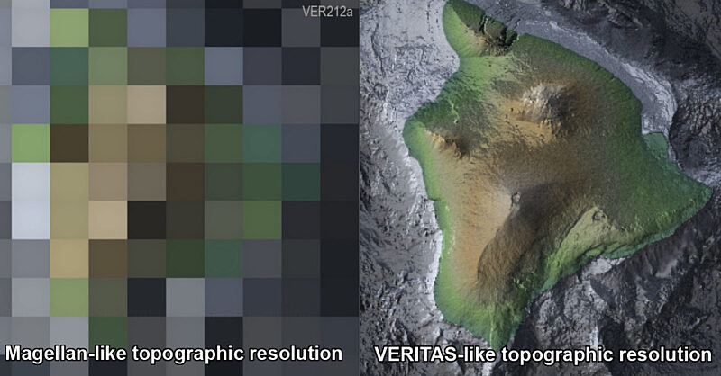
VERITAS will also dramatically improve our knowledge of the planet’s topography. The appearance of a planet’s surface has limited utility if you cannot also determine whether a circular feature is a high-elevation hill or a low-elevation crater. Magellan’s radar was extremely limited in its ability to detect changes in elevation. To use another representative example from Earth, the orbiter could have determined that Hawaii was an island, but details on the flanks of the volcano would have been invisible. The horizontal resolution of VERITAS’ topographic map will be 60 times better than Magellan’s.

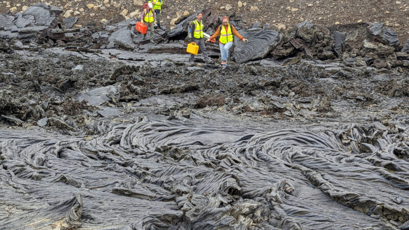
To complete it proverbial triple crown, VERITAS’ radar can detect tectonic and volcanic activity. Interferometric Synthetic Aperture Radar (InSAR) is a technique which is often used to monitor changes in landscapes on Earth. This is a complicated process, but on a basic level, scientists merge two radar images to produce a figure called a “butterfly diagram.” Areas which are surrounded by a striped pattern resembling a bar code experienced uplift or subsidence between the acquisitions of the two images. This is particularly useful for detecting volcanic activity, since volcanoes will slightly swell as magma rises towards the surface. InSAR is one of the reasons why volcanologists know that an eruption in Iceland is imminent. The drawback of this technique is that the spacecraft must follow an extremely precise trajectory. As it collects the second radar image, it must be within 160 meters of the point where the first image was captured. VERITAS is the first spacecraft to have this capability. It can detect miniscule elevation changes as small as 1.5 centimeters.

VERITAS’ fourth key capability is enabled by an international partnership between NASA and the German Aerospace Center (DLR). German scientists are building an infrared spectrometer for the spacecraft called the Venus Emissivity Mapper (VEM). While Venus’ atmosphere is opaque from the perspective of a human observer, it can be penetrated by five narrow wavelengths of infrared light. VEM takes advantage of these “windows” to detect different minerals and rock types on the planet’s surface. Most notably, it will be used to study large, rugged, and elevated plateaus known as tesserae. If VEM detects granite in these areas, it will suggest that they are analogous to Earth’s continents.
VEM is also designed to detect rocks which were deposited by water, such as limestone. This would be a historic discovery, but it is unclear whether sedimentary rocks can be found in large patches which can be detected by the instrument. Venus’ thick atmosphere blurs infrared light as it passes through, so VEM can only see large features which are more than 100 kilometers in diameter. In any case, spectroscopy will greatly improve our understanding of the history of Venus, just as it has expanded our understanding of Mars’ ancient past.

Finally, VERITAS will map Venus’ gravitational field. The massive antennae of the Deep Space Network will track the spacecraft as it orbits Venus and detect slight changes in its velocity. The radio signals will allow the VERITAS team to determine whether the planet has a liquid core. In addition, they will be used to measure the sizes of the core and the mantle. These observations will help Venus scientists estimate how much volcanic activity is present on Venus and investigate whether the planet has active plate tectonics.
The scientific case for VERITAS is clear. Unfortunately, the future of the mission is far from certain. One year after it was selected for development, VERITAS became an innocent victim of the COVID-19 pandemic. Issues related to telework and the aerospace supply chain forced NASA to postpone the launch of the Psyche mission to a metallic asteroid by one year. The delay forced NASA and the Jet Propulsion Laboratory (JPL) to redirect a portion of their funding and their workforce to Psyche. They ultimately elected to take these resources from VERITAS. It was a logical choice. Of JPL’s interplanetary probes, VERITAS was the furthest from launch, so a delay to its launch date would have the fewest knock-on effects.
Psyche launched atop a Falcon Heavy rocket last month, but that does not mean that VERITAS is cleared to follow in its footsteps. NASA stipulated that the construction of the spacecraft cannot commence until two additional JPL missions, the Europa Clipper and the NISAR Earth science mission, also reach the launch pad. The agency’s planetary science program is struggling to afford all of its missions due to cost overruns for Clipper and the ambitious Mars Sample Return campaign. To minimize these financial issues, the launch of VERITAS is currently delayed indefinitely. Absent a change in plans, the earliest it could fly is in 2031.
This decision was met with consternation by the Venus science community. The Planetary Society and the American Geophysical Union (AGU) led a letter-writing campaign to petition Congress to allocate additional funding for VERITAS. There are recent signs that this effort is bearing fruit. The Appropriations Committee of the U.S. House of Representatives is responsible for drafting NASA’s budget. In its budget proposal for Fiscal Year 2024, this group of Congresspeople wrote, “The Committee supports the Discovery Program, including competitively selected missions such as the (VERITAS) mission. The Committee recommends that NASA request sufficient funding to ensure a launch by the end of the decade. The Committee directs NASA to provide a budget profile to ensure that the mission can remain on track.” [4]
The ramifications of this statement remain unclear. The House of Representatives and the Senate still need to agree on a final budget, which may or may not include support for VERITAS. Based on the language in the proposal, it also appears that the House is asking NASA to request money for the mission in the future, rather than restarting it immediately. However, Congress’ support for VERITAS reflects the growing public support for Venus exploration. Europa Clipper is also slated to launch next year, which will free up resources which can be directed towards this mission.

NASA’s VERITAS mission will revolutionize our understanding of Venus by mapping its surface in detail for the first time. Its five datasets will teach us about the planet’s bizarre geology and help us determine whether it was habitable for life in the ancient past. Sue Smrekar, VERITAS’ Principal Investigator, hopes to begin developing her team’s spacecraft within a year in pursuit of a November 2029 launch date [5]. In turn, this earlier launch date would permit VERITAS to build an authoritative map of Venus prior to the launches of NASA’s DAVINCI atmospheric probe and the European Space Agency’s heavily-instrumented EnVision orbiter. While discussions on funding are ongoing, there is growing support inside and outside of NASA for VERITAS. Until this mission takes flight – hopefully, before this decade is out – Venus scientists will continue to await and prepare for its bonanza of discoveries.