
On Aug. 21, 2017, a total solar eclipse passed over North America. People throughout the continent captured incredible images of this celestial phenomenon. We and our partner agencies had a unique vantage point on the eclipse from space. Here are a few highlights from our fleet of satellites that observe the Sun, the Moon and Earth.
Our Solar Dynamics Observatory, or SDO, which watches the Sun nearly 24/7 from its orbit 3,000 miles above Earth, saw a partial eclipse on Aug. 21.
SDO sees the Moon cross in front of the Sun several times a year. However, these lunar transits don’t usually correspond to an eclipse here on Earth, and an eclipse on the ground doesn’t guarantee that SDO will see anything out of the ordinary. In this case, on Aug. 21, SDO did see the Moon briefly pass in front of the Sun at the same time that the Moon’s shadow passed over the eastern United States. From its view in space, SDO only saw 14 percent of the Sun blocked by the Moon, while most U.S. residents saw 60 percent blockage or more.
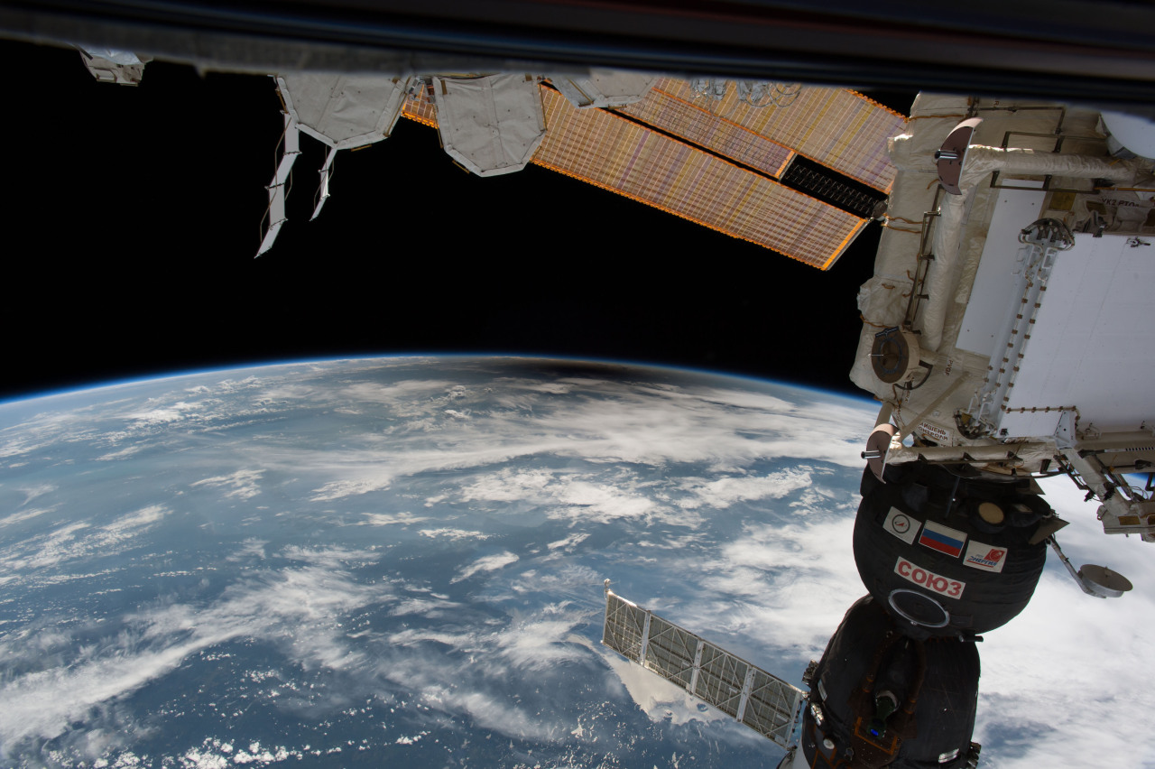
Six people saw the eclipse from the International Space Station. Viewing the eclipse from orbit were NASA’s Randy Bresnik, Jack Fischer and Peggy Whitson, the European Space Agency’s Paolo Nespoli, and Roscosmos’ Commander Fyodor Yurchikhin and Sergey Ryazanskiy. The space station crossed the path of the eclipse three times as it orbited above the continental United States at an altitude of 250 miles.
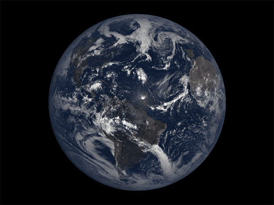
From a million miles out in space, our Earth Polychromatic Imaging Camera, or EPIC, instrument captured 12 natural color images of the Moon’s shadow crossing over North America. EPIC is aboard NOAA’s Deep Space Climate Observatory, or DSCOVR, where it photographs the full sunlit side of Earth every day, giving it a unique view of the shadow from total solar eclipses. EPIC normally takes about 20 to 22 images of Earth per day, so this animation appears to speed up the progression of the eclipse.
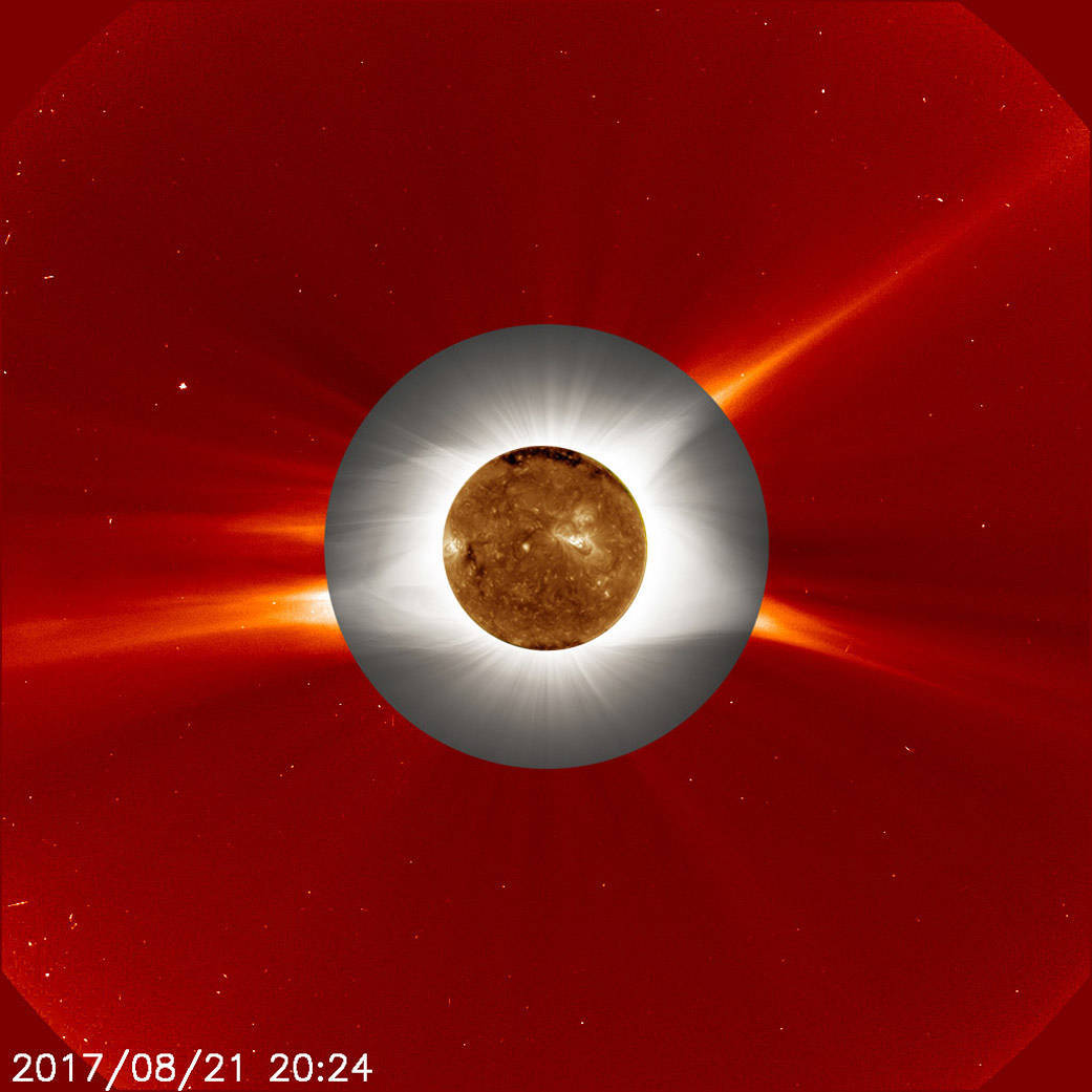
A ground-based image of the total solar eclipse – which looks like a gray ring – is superimposed over a red-toned image of the Sun’s atmosphere, called the corona. This view of the corona was captured by the European Space Agency and our Solar and Heliospheric Observatory, or SOHO. At center is an orange-toned image of the Sun’s surface as seen by our Solar Dynamics Observatory in extreme ultraviolet wavelengths of light.
During a total solar eclipse, ground-based telescopes can observe the lowest part of the solar corona in a way that can’t be done at any other time, as the Sun’s dim corona is normally obscured by the Sun’s bright light. The structure in the ground-based corona image — defined by giant magnetic fields sweeping out from the Sun’s surface — can clearly be seen extending into the outer image from the space-based telescope. The more scientists understand about the lower corona, the more they can understand what causes the constant outward stream of material called the solar wind, as well as occasional giant eruptions called coronal mass ejections.
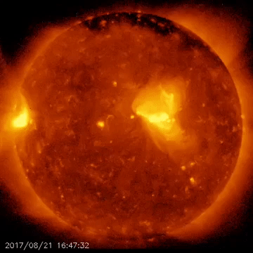
As millions of Americans watched the total solar eclipse that crossed the continental United States, the international Hinode solar observation satellite captured its own images of the awe-inspiring natural phenomenon. The images were taken with Hinode’s X-ray telescope, or XRT, as it flew above the Pacific Ocean, off the west coast of the United States, at an altitude of approximately 422 miles. Hinode is a joint endeavor by the Japan Aerospace Exploration Agency, the National Astronomical Observatory of Japan, the European Space Agency, the United Kingdom Space Agency and NASA.
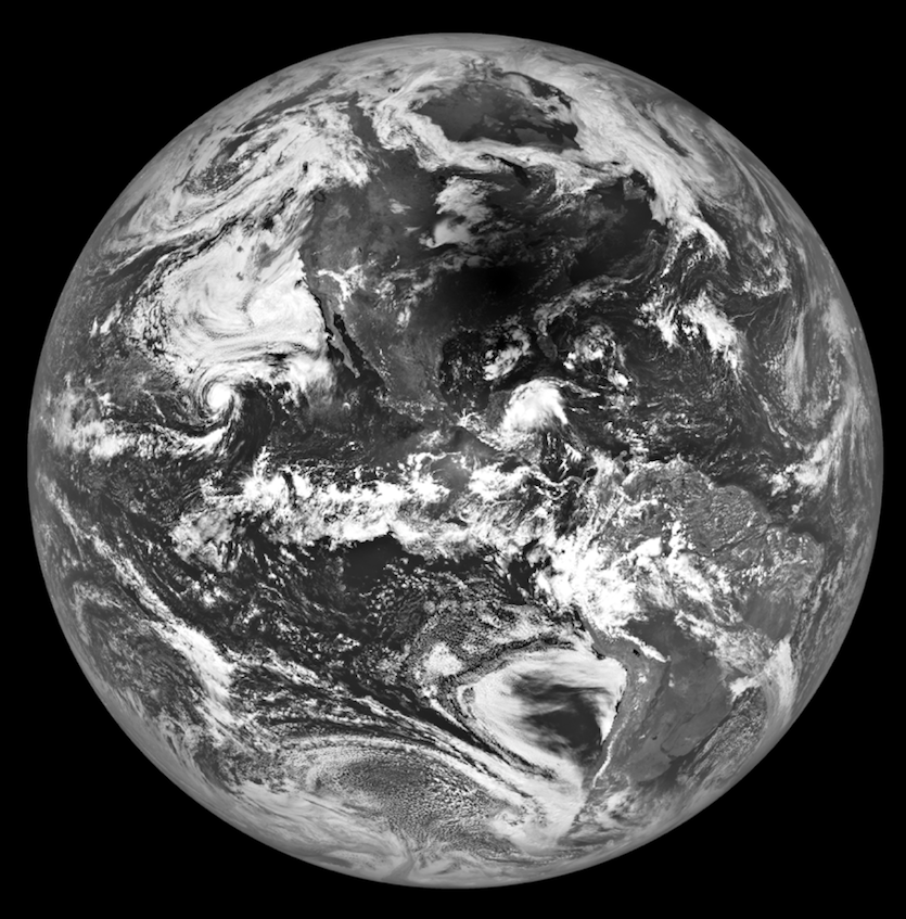
During the total solar eclipse our Lunar Reconnaissance Orbiter, or LRO, in orbit around the Moon, turned one of its instruments towards Earth to capture an image of the Moon’s shadow over a large region of the United States.
As LRO crossed the lunar south pole heading north at 3,579 mph, the shadow of the Moon was racing across the United States at 1,500 mph. A few minutes later, LRO began a slow 180-degree turn to look back at Earth, capturing an image of the eclipse very near the location where totality lasted the longest. The spacecraft’s Narrow Angle Camera began scanning Earth at 2:25:30 p.m. EDT and completed the image 18 seconds later.
Sensors on the polar-orbiting Terra and Suomi NPP satellites gathered data and imagery in swaths thousands of miles wide. The Moderate Resolution Imaging Spectroradiometer, or MODIS, sensor on Terra and Visible Infrared Imaging Radiometer Suite, or VIIRS, on Suomi NPP captured the data used to make this animation that alternates between two mosaics. Each mosaic is made with data from different overpasses that was collected at different times.
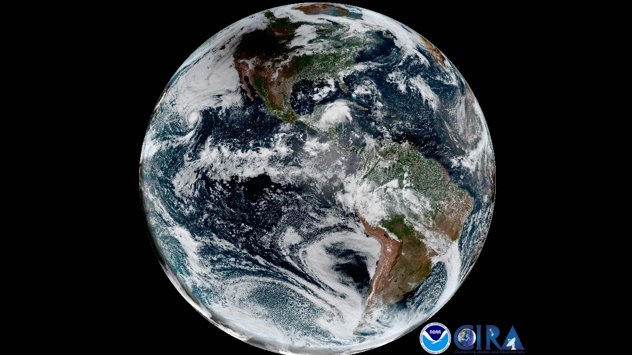
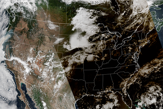
This full-disk geocolor image from NOAA/NASA’s GOES-16 shows the shadow of the Moon covering a large portion of the northwestern U.S. during the eclipse.
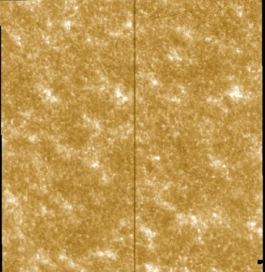
Our Interface Region Imaging Spectrograph, or IRIS, mission captured this view of the Moon passing in front of the Sun on Aug. 21.
Check out nasa.gov/eclipse to learn more about the Aug. 21, 2017, eclipse along with future eclipses, and follow us on Twitter for more satellite images like these: @NASASun, @NASAMoon, and @NASAEarth.
Make sure to follow us on Tumblr for your regular dose of space: http://nasa.tumblr.com.